Highlights van Benin

Benin is niet de eerste vakantie bestemming waar je aan zult denken als je aan Afrika denkt. Toch is het het overwegen waard: hoewel straat arm, is het toerisme nog lekker kleinschalig, de omvang van het land maakt het land goed bereisbaar en bovenal: de natuur is prachtig. Een aanrader voor reizigers die eens iets ander willen.
Natuur
- Pendjari - bosrijk national park met veel groot wild waaronder olifanten en nijlpaarden


World Heritage Sites
- Koninklijke paleizen van Abomey

Typisch
| nationale gerechten | Kuli-Kuli |
Klimaat
| Temperatuur | Beste tijd voor een reis |

|

|
Typisch
| Officiële landsnaam | Republiek Benin |
| Hoofdstad | Porto-Novo |
| Nationaliteit | Beniner |
| Talen | frans |
| Visum nodig? | Ja |
| Munteenheid | CFA-frans (XOF) |
| Regeringsvorm | republiek |
| Grootte t.o.v. Nederland | 2.7 keer groter |
| Bevolking | 8.3 miljoen |
| Bevolkingsdichtheid t.o.v. Nederland | 5.4 keer lager |
| Laagste punt | 0 m |
| Hoogste punt | 658 m |
Exotische ziekten
- malaria
- hepatitis A
- typhus
- gele koorts
Interessante boeken over Benin
-
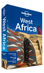
Reisgids Lonely Planet West Africa - Marokko, Mauretanië, Mali, Niger, Senegal, Gambia, Burkina Faso, Kameroen, Nigeria, Benin, Togo, Ghana, Ivoorkust, Liberia | Lonely Planet | 23.95 €

De perfecte reisgids voor zowel de georganiseerde als de zelfstandige reiziger. Naast een algemene inleiding van het land / streek vol met praktisch... meer
De perfecte reisgids voor zowel de georganiseerde als de zelfstandige reiziger. Naast een algemene inleiding van het land / streek vol met praktische informatie over hoe je er het beste kunt reizen: slapen, eten, vervoer, excursies ... alles kun je er in vinden.
Mauretanië, Mali, Niger, Senegal, Gambia, Burkina Faso, Kameroen, Nigeria, Benin, Togo, Ghana, Ivoorkust, Liberia, Siera Leone, Guinea, Guinea Bissau, Marokko
West Africa has cachet and soul. Home to African landscapes of our imaginations and inhabited by an astonishing diversity of traditional peoples, this is Africa as it once was.Inspirational images, destination highlights and recommendations from our expert authorsPlanning features and top itineraries to help you plan the perfect tripLocal secrets and hidden travel gems that will make your trip uniquePLUS Music, Arts and Craftwork, Peoples of West Africa and Safe Travel essaysCoverage includes: Planning chapters, Benin, Burkina Faso, Cameroon, Cameroon, Cape Verde,Côte d'Ivoire, The Gambia, Ghana, Guinea-Bissau, Liberia, Mauritania, Morocco, Nigeria, Senegal, Sierra Leone, Togo, Understand and Survival chapters. -
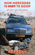
Reisverhaal Mijn Mercedes is niet te koop - Jeroen van Bergeijk | Pandora pockets | 7.98 €

Wanneer Jeroen van Bergeijk in Burkina Faso in een Mercedes-taxi stapt en een vergeelde sticker van voetbalclub PSV op het dashboardkastje ziet, begin... meer
Wanneer Jeroen van Bergeijk in Burkina Faso in een Mercedes-taxi stapt en een vergeelde sticker van voetbalclub PSV op het dashboardkastje ziet, begint zijn fantasie te leven. Niets aan de auto herinnert nog aan zijn land van herkomst: springveren steken door de stoelen en de motorkap zit vol roestplekken. Hoe is die auto hier terechtgekomen? Een jaar later reist Van Bergeijk in een oude Mercedes Diesel van Amsterdam naar West-Afrika. Hij doorkruist Marokko, de woestijn van Mauretanië, de binnenlanden van Mali en Ghana, en belandt via Togo en Benin in Ouagadougou. Hij krijgt pech met zijn Mercedes en maakt een staatsgreep mee in Togo. Onderweg gaat hij op zoek naar de handelaren en avonturiers die in oude auto's door de woestijn crossen om ze in Afrika met winst te verkopen. 'Hartverwarmend en met humor geschreven.' Toronto Star
Vakantiebestemmingen met vergelijkbare kenmerkenMisschien bent u ook geïnteresseerd in andere vakantielanden met de volgende kenmerken: |
Reis en Vakantie Top 10Benin is vertegenwoordigd in de volgende reis top10's: |
- © 2010-2015 top10gezien.nl
- over deze site
- disclaimer
- adverteren
- contact

