Highlights van Oceanië
Typisch
Klimaat
| Temperatuur | Beste tijd voor een reis |

|

|
Typisch
| Officiële landsnaam | Oceanië |
Interessante boeken over Oceanië
-
DVD Australië | Landen achter de Horizon | 9.95 €
.jpg)
Deze reisdocumentaire over Australië laat u kennismaken met de subtiele schoonheid van dit oudste continent ter wereld, met recht een 'wereld apart'... meer
Deze reisdocumentaire over Australië laat u kennismaken met de subtiele schoonheid van dit oudste continent ter wereld, met recht een 'wereld apart'. De reis voert u door drie staten: New South Wales, Queensland en de Northern Territory.
U wordt verrast door de enorme diversiteit van het continent: mondaine steden, indrukwekkende landschappen en sterk contrasterende klimatologische omstandigheden.
Maar ook de enorme uitgestrektheid van het gebied, de gemoedelijke sfeer van het dagelijkse leven, de vriendelijke en opgewekte bevolking en de wonderbaarlijke dierenwereld; alles draagt bij tot een onvergetelijke ervaring 'Down Under!'NEW SOUTH WALES: Sydney, Gosford Reptile Park, Cessnock, Port Macquaire, Grafton, Lismore.
QUEENSLAND: Brisbane, Fraser Island, Rockhampton, Great Barrier Reef, Whitsunday Islands, Townsville, Cairns, Silky Oaks, Daintree River, Port Douglas, Lizard Island, Kuranda, Mount Isa.
NORTHERN TERRITORY: Tennant Creek, Alice Springs, Uluru National Park, Ayers Rock, Katherine Gorge National Park, Darwin, Crocodile Farm, Territory Wild Life Park, Tiwi Islands, Melville Island, Kakadu National Park.
-
Landkaart - wegenkaart Queensland state map | Hema Maps | 11.25 €
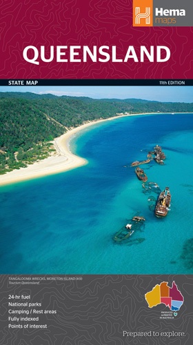
Goede, overzichtelijke, leesbare kaart van de hele provincie. Nationale Parken zijn er goed op te vinden en de afstanden worden weergegeven. Op de a... meer
Goede, overzichtelijke, leesbare kaart van de hele provincie. Nationale Parken zijn er goed op te vinden en de afstanden worden weergegeven. Op de achterkant nog deelkaartjes van enkele steden en NP s.
A state map of Queensland accompanied by touring information and relevant regional and city maps. Marked on the map are national parks, points of interest, 24-hour fuel as well as camping and rest areas. On the reverse are maps of the Gold Coast, South East Queensland and Tropical North Queensland as well as CBD and throughroads maps of Brisbane. There is a full index included, as well as all national park information.Features:Points of interest24-hour fuelNational parksCamping areasRest areasFully indexedComprehensive road detailRoad identification numberingScenic photographs
Vakantiebestemmingen met vergelijkbare kenmerkenMisschien bent u ook geïnteresseerd in andere vakantielanden met de volgende kenmerken: |
Reis en Vakantie Top 10Oceanië is vertegenwoordigd in de volgende reis top10's: |
Bestemmingen in Oceanië
| Australië | Micronesië | Papoea-Nieuw-Guinea | Tonga |
| Fiji | Nauru | Salomon eilanden | Tuvalu |
| Kiribati | Nieuw-Zeeland | Samoa | Vanuatu |
| Marshall eilanden | Palau |

- © 2010-2015 top10gezien.nl
- over deze site
- disclaimer
- adverteren
- contact