Highlights van Djibouti

Ben je een fan van warmte dan zou Djibouti weleens jouw vakantie bestemming kunnen zijn. Daarnaast kun je hier prima je snorkel trip kunnen combineren met een bezoek aan de woestijn. Veel toeristen zul je trouwens niet tegenkomen - Djibouti heeft jarenlang niet op de toeristenradar gestaan door politieke onrust. Nu prima te bezoeken voor een reis of vakantie!
Natuur
- Assalmeer - zoutwatermeer dat een heel palet aan kleuren herbergt. Een van de warmste plekken op aarde.


World Heritage Sites
- geen

Typisch
| nationale gerechten | Skoudehkaris |
Klimaat
| Temperatuur | Beste tijd voor een reis |

|

|
Typisch
| Officiële landsnaam | Republiek Djibouti |
| Hoofdstad | Djibouti |
| Nationaliteit | Djiboutiaan |
| Talen | arabisch, frans |
| Visum nodig? | Ja |
| Munteenheid | Djibouti Franc (DJF) |
| Regeringsvorm | republiek |
| Grootte t.o.v. Nederland | 1.8 keer kleiner |
| Bevolking | 0.5 miljoen |
| Bevolkingsdichtheid t.o.v. Nederland | 18.2 keer lager |
| Laagste punt | -155 m |
| Hoogste punt | 2028 m |
Exotische ziekten
- malaria
- hepatitis A
- typhus
Interessante boeken over Djibouti
-
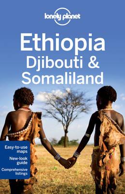
Reisgids Lonely Planet Ethiopia, Djibouti, Somaliland - Ethiopië | Lonely Planet | 22.95 €

De perfecte reisgids voor zowel de georganiseerde als de zelfstandige reiziger. Naast een algemene inleiding van het land / streek vol met praktisch... meer
De perfecte reisgids voor zowel de georganiseerde als de zelfstandige reiziger. Naast een algemene inleiding van het land / streek vol met praktische informatie over hoe je er het beste kunt reizen: slapen, eten, vervoer, excursies ... alles kun je er in vinden. Engelstalig. Lonely Planet
Travelling around Ethiopia, Djibouti and Somaliland is a life-altering experience. Together, these three countries offer a heady mix of otherworldly landscapes, captivating cultures, historical wonders and sensational outdoor activities.- Inspirational photos
- Expert recommendations
- 100% researched and updated
- Clear, easy-to-use maps and at-a-glance practical info
Coverage Includes: Planning chapters, Addis Ababa, Northern Ethiopia, Southern Ethiopia, Eastern Ethiopia, Western Ethiopia, Djibouti, Somaliland, Understand and Survival chapters. -
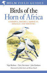
Vogelgids Birds of the Horn of Africa Ethiopia, Eritrea, Djibouti, Somalia and Socotra | Helm field guides | 49.95 €

The Horn of Africa has the highest endemism of any region in Africa, and around 70 species are found nowhere else in the world. Many of these are co... meer
The Horn of Africa has the highest endemism of any region in Africa, and around 70 species are found nowhere else in the world. Many of these are confined to the isolated highlands of Ethiopia and Eritrea, but a large number of larks specialise in the arid parts of Somalia and adjoining eastern Ethiopia, whilst the island of Socotra has its own suite of endemic species. The region is also an important migration route and wintering site for many Palearctic birds. This is the first field guide to the birds of this fascinating region, and a companion to Birds of East Africa by two of the same authors. Over 200 magnificent plates by John Gale and Brian Small illustrate every species that has ever occurred in the five countries covered by the guide, and the succinct text covers the key identification criteria. Special attention is paid to the voices of the species, and over 1000 up-to-date colour distribution maps are included. This long-awaited guide is a much-needed addition to the literature on African birds and an essential companion for birders visiting the region.
Vakantiebestemmingen met vergelijkbare kenmerkenMisschien bent u ook geïnteresseerd in andere vakantielanden met de volgende kenmerken: |
Reis en Vakantie Top 10Djibouti is vertegenwoordigd in de volgende reis top10's:
|
- © 2010-2015 top10gezien.nl
- over deze site
- disclaimer
- adverteren
- contact
