Highlights van Tanzania
Natuur
- Serengeti - enorme grasvlakte met nog meer dieren
- Ngoronggoro-krater - het paradijs voor wildlife watching
- Kilimanjaro - de hoogste berg van Afrika en een must-see+NR207
- Kilimanjaro - het beklimmen van de berg staat voor fantastische uitzichten op de steppen onder je


World Heritage Sites
- Beschermd gebied van de Ngorongoro
- Ruïnes van Kilwa Kisiwani en de ruïnes van Songo Mnara
- Nationaal park Serengeti
- Wildreservaat Selous
- Nationaal park Kilimanjaro
- Stone Town op het eiland Zanzibar
- Prehistorische rotsschilderingen van Kondoa

Typisch
| nationale gerechten | ugali |
Klimaat
| Kenmerken |
|
| Temperatuur | Beste tijd voor een reis |

|

|
Typisch
| Officiële landsnaam | Verenigde Republiek Tanzania |
| Hoofdstad | Dar Es Salaam |
| Nationaliteit | Tanzaniaan |
| Talen | overig |
| Visum nodig? | Ja |
| Munteenheid | Tanzaniaanse Shilling (TZS) |
| Regeringsvorm | republiek |
| Grootte t.o.v. Nederland | 22.8 keer groter |
| Bevolking | 40.2 miljoen |
| Bevolkingsdichtheid t.o.v. Nederland | 9.4 keer lager |
| Laagste punt | 0 m |
| Hoogste punt | 5895 m |
Exotische ziekten
- pest
- malaria
- hepatitis A
- typhus
Interessante boeken over Tanzania
-
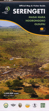
Wegenkaart - Landkaart Serengeti, Masai Mara, Ngorogoro and Oldupai | Harvey Maps | 22.95 €

Mooie kaart van een gedeelte van de Serengeti, Masai Mara, Ngorogoro en Oldupai met veel extra informatie. Offical map and visitor guide of Sereng... meer
Mooie kaart van een gedeelte van de Serengeti, Masai Mara, Ngorogoro en Oldupai met veel extra informatie.
Offical map and visitor guide of Serengeti, Masai Mara, Ngorogoro and Oldupai
Detailed map made in collaboration with Frankfurt Zoological Society
The only fully detailed map of this entire eco-system, this map embodies years of research done by Frankfurt Zoological Society and is the official management map for staff in the field
This is far more than just a map: on the reverse side is a wealth of authorative information including migration patterns, wildlife, the peoples of the Serengeti, climate, landscape and habitat. Front cover, and other Visitor Guide photos, by Felix Borner.
Shows tracks, seasonal tracks and major camps
Migration patterns and the Serengeti-Mara eco-system
Checklist of large mammals
Climate, habitat, the people, history
Enlarged (1:125,000 scale) inset maps of Grumeti River and Seronera
Map size 960x1088mm, folded top 272x120mm.
Supplied in a protective plastic pocket
Scale 1:250,000 -
Reisgids Lonely Planet Tanzania | Lonely Planet | 22.95 €

De perfecte reisgids voor zowel de georganiseerde als de zelfstandige reiziger. Naast een algemene inleiding van het land / streek vol met praktisch... meer
De perfecte reisgids voor zowel de georganiseerde als de zelfstandige reiziger. Naast een algemene inleiding van het land / streek vol met praktische informatie over hoe je er het beste kunt reizen: slapen, eten, vervoer, excursies ... alles kun je er in vinden.
Wildlife galore, idyllic beaches, snow-capped Kilimanjaro, moss-covered ruins, friendly people, fascinating cultures – Tanzania has all this and more wrapped up in one adventurous and welcoming package.12 walking safaris in ‘big game’ areas, iInfinite views from the summit of Mt Kilimanjaro, 500 Zanzibari carved wooden doors (5 Zanzibari coffee spots) and 14,000 sq km of Serengeti wildernessInspirational photosClear, easy-to-use mapsComprehensive planning toolsIn-depth backgroundEasy-to-read layoutAt-a-glance practical infoCoverage includes: Planning chapters, Dar es Salam, Zanzibar Archipelago, Northeastern Tanzania, Northern Tanzania, Central tanzania, Lake Victoria, Western Tanzania, Southern Highlands, Southeastern Tanzania, Understand and Survival Guide chapters
Reis en Vakantie Top 10Tanzania is vertegenwoordigd in de volgende reis top10's:
|
- © 2010-2015 top10gezien.nl
- over deze site
- disclaimer
- adverteren
- contact
