Highlights van Zuid-Afrika
Natuur
- Kruger National Park
- Marakele Wildpark - natuurpark van een Nederlandse ondernemer
- Drakensberge - waanzinnige hoeveelheid plantensoorten en de aanwezigheid van een grote diversiteit aan dieren maken dit gebied een must-see


World Heritage Sites
- Moeraslandpark Greater St. Lucia
- Robbeneiland
- De gebieden met fossielen van hominides in Sterkfontein & Swartkrans & Kromdraai en omgeving
- Nationaal park Drakensberg
- Cultureel landschap Mapungubwe
- De beschermde gebieden van de Floraregio van de Kaap
- Vredefortkrater
- Het Cultureel en botanisch landschap van Richtersveld

Klimaat
| Kenmerken |
|
| Temperatuur | Beste tijd voor een reis |

|

|
Typisch
| Officiële landsnaam | Republiek Zuid-Afrika |
| Hoofdstad | Pretoria |
| Nationaliteit | Zuid-Afrikaan |
| Talen | overig, engels, Nederlands |
| Visum nodig? | Nee |
| Munteenheid | Rand (ZAR) |
| Regeringsvorm | republiek |
| Grootte t.o.v. Nederland | 29.4 keer groter |
| Bevolking | 43.8 miljoen |
| Bevolkingsdichtheid t.o.v. Nederland | 11.2 keer lager |
| Laagste punt | 0 m |
| Hoogste punt | 3408 m |
Tags
Bergen Zee en strand tropisch savanne woestijn steppe subtropisch mediterraan Wintersport Duiken Backpacken wildlifeLow-cost airlines
- Air Berlin
Exotische ziekten
- malaria
- hepatitis A
- typhus
Interessante boeken over Zuid-Afrika
-
Reisgids Johannesburg Wallpaper | Phaidon Press | 9.95 €

"Wallpaper City Guides" not only suggest where to stay, eat, and drink, but what the tourist passionate about design might want to see, whether he/she... meer
"Wallpaper City Guides" not only suggest where to stay, eat, and drink, but what the tourist passionate about design might want to see, whether he/she has a week or 24 hours in the city. Featured are up and coming areas, landmark buildings in an 'Architour', design centers, and the best shops to buy items unique to that city. "Wallpaper City Guides" present travelers with a fast-track ticket to the chosen location. The edited guides offer the best, most exciting, and the most beautiful of that particular city. As well as looking beautiful, the guides are expertly designed with function as a priority, and have tabbed sections so that the tourist can easily find what they are looking for. There are maps, rate and currency cards, color-coded parts of the city, and an easy navigational tool. They are the ultimate combination of form and function.
About the AuthorWallpaper* City Guides are compiled by the magazine's travel experts, both by in-house editors, and correspondents who live in the highlighted cities, and provide up-to-the-minute information.
-
Landkaart - Wegenkaart 10 Western Cape Road Map | Map Studio | 13.25 €
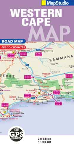
Road map of the Western Cape Province with an enlargement for the Cape Peninsula and 27 street plans of the central areas in main towns. The map is ... meer
Road map of the Western Cape Province with an enlargement for the Cape Peninsula and 27 street plans of the central areas in main towns. The map is annotated numerous places of interest, vineyards, etc. GPS coordinates are provides for main road junctions.
The map is double-sided, dividing the province east/west, and shows its road and rail networks. Unsurfaced minor roads and selected 4WD tracks are included and GPS coordinates are provided for over 150 road junctions. Railways are shown with stations.
Numerous places of interest are highlighted, including wineries, historical sites, nature reserves, bird watching sites, etc. Topography is indicated only by mountain passes marked along the roads and occasional spot heights. Nature reserves and other protected areas are prominently marked. The map is indexed and in addition to the tables with GPS coordinates for road junctions has latitude and longitude margin ticks at intervals of 1°.
An enlargement shows the Cape Peninsula in greater detail. Street plans, annotated with places of interest show central areas in 27 main towns, including Cape Town. Also provided is a list of useful contact details for tourist offices, wineries, etc.
Vakantiebestemmingen met vergelijkbare kenmerkenMisschien bent u ook geïnteresseerd in andere vakantielanden met de volgende kenmerken: |
Reis en Vakantie Top 10Zuid-Afrika is vertegenwoordigd in de volgende reis top10's:
|

- © 2010-2015 top10gezien.nl
- over deze site
- disclaimer
- adverteren
- contact