Highlights van Griekenland
Natuur
- Tempel van Apollo Epicurius te Bassae
- Archeologische plaats Delphi
- Akropolis van Athene
- De berg Athos
- Meteoraklooster
- Oudchristelijke en Byzantijnse monumenten van Thessaloniki
- Archeologische plaats Epidaurus
- De middeleeuwse stad Rhodos
- Mystras
- Archeologische plaats Olympia
- Delos
- Kloosters van Daphni & Osios Loukas en Nea Moni van Chios
- Pythagoreion en Heraion van Samos
- Archeologische plaats Vergina
- Archeologische plaatsen Mycene en Tiryns
- Historisch centrum Chorá met het Klooster van de Heilige Johannes "de Theoloog" en de Grot van de Apocalypsis op het eiland Pátmos
- De oude stad van Korfoe


Cultuur
- Parthenon - het beroemdste monument op de Acropolis en van het oude Griekenland

Typisch
| nationale gerechten | moussaka |
| nationale dranken | Ouzo |
| beroemd om | homerus ilias en oddysee peleponnesus |
Klimaat
| Kenmerken |
|
| Temperatuur | Beste tijd voor een reis |

|

|
Typisch
| Officiële landsnaam | Helleense Republiek |
| Hoofdstad | Athene |
| Nationaliteit | Griek |
| Talen | overig |
| Visum nodig? | Nee |
| Munteenheid | Euro (EUR) |
| Regeringsvorm | parlementaire republiek |
| Grootte t.o.v. Nederland | 3.2 keer groter |
| Bevolking | 10.7 miljoen |
| Bevolkingsdichtheid t.o.v. Nederland | 4.9 keer lager |
| Laagste punt | 0 m |
| Hoogste punt | 2917 m |
Low-cost airlines
- Arke Fly
- Air Berlin
- Transavia
- Corendon
- Thomas Cook
Interessante boeken over Griekenland
-
Wandelgids Western Crete 45 walks in Kissamos and Selinos | Cicerone | 15.95 €
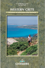
Guidebook to walking in the Kissamos and Selinos areas of Crete. Kissamos, situated in western Crete, offers a rich variety of landscape for the walke... meer
Guidebook to walking in the Kissamos and Selinos areas of Crete. Kissamos, situated in western Crete, offers a rich variety of landscape for the walker to explore. A wide selection of mountain treks, ridge and hill walks, gorge explorations, cliff and coastal walks, and rambles from village to village and through the many archaeological wonders Crete has to offer.
Seasons
Best months are April, May, early June, September and October. July and August are too hot unless you only want a stroll.Centres
Access normally through Chania. Bases include Kolimbari, Afrata, Ravdouha, Nopigia, Kastelli. Kaliviani, Falasarna, Platanos, Katsomatados, Elos, Kefali, Elafinisos, Paleochora and Kandanis.Difficulty
Routes not too long but waymarking is limited, water needs careful management and rescue is unlikely.Must See
Greek hospitaity, views down on the sandy beaches and stark rocky cliffs, an ancient civilisation. -
Wandelkaart 32. Mount Kissavos | Road Editions | 5.25 €
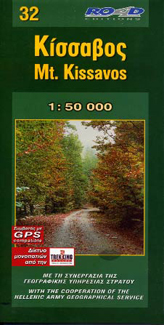
Kissavos at 1:50,000 in a series of contoured maps from Road Editions covering popular hiking areas of Greece. All the maps have altitude coloring a... meer
Kissavos at 1:50,000 in a series of contoured maps from Road Editions covering popular hiking areas of Greece. All the maps have altitude coloring and spot heights - contour interval varies, as indicated in the descriptions of individual titles. Local footpaths are marked and, for road users the maps show picturesque routes, intermediate driving distances on minor roads, and locations of petrol stations and tyre repairs workshops. Boundaries of national parks and administrative regions are marked, and symbols show campsites, hotels and mountain refuges, and various landmarks and places of interest, e.g. archaeological sites, churches, etc. All place names are in both Greek and Latin alphabet.
All the titles have latitude and longitude margin ticks, many also show GPS waypoints. Some maps come with a booklet or notes on the reverse side giving further information about the area and/or descriptions of hiking routes. Map legends include English.
In this title: coverage from Omolio in the north to Dimitra in the south and from the village Evangilismos in the west to the coast. A booklet, in Greek and English, includes an index and general information about the area.

Vakantiebestemmingen met vergelijkbare kenmerkenMisschien bent u ook geïnteresseerd in andere vakantielanden met de volgende kenmerken: |
Reis en Vakantie Top 10Griekenland is vertegenwoordigd in de volgende reis top10's:
|

- © 2010-2015 top10gezien.nl
- over deze site
- disclaimer
- adverteren
- contact